Potential Tropical Cyclone 8 Forms Off Southeast Coast, Impacts Expected
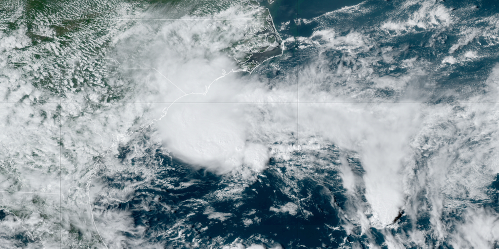
Potential Tropical Cyclone Eight (PTC 8), previously Invest 95L, has formed approximately 100 miles from Charleston, South Carolina. It is anticipated to develop into Tropical Storm Helene early this week.
Current Warnings and Watches
A Tropical Storm Warning has been issued for the coasts of North Carolina and South Carolina, extending from Edisto Beach, South Carolina, to Ocracoke Inlet, North Carolina.
Forecast and Potential Impacts
PTC 8 is expected to bring gusty winds, heavy rainfall with potential flash flooding, coastal flooding, and hazardous beach conditions to portions of the Southeast and mid-Atlantic coasts over the next couple of days. The system may become a subtropical or tropical storm within the next day.
Rainfall Forecast
Computer models predict widespread rainfall of 2-5 inches, with higher amounts possible east of Interstate 95. Coastal communities such as Myrtle Beach, Wilmington, and Morehead City may experience significant rainfall. Additionally, inland cities like Raleigh, Charlotte, and Richmond are forecast to receive 1-3 inches of rain.
Coastal Concerns
The formation of PTC 8 increases the risk of rip currents and coastal erosion, particularly along the Outer Banks of North Carolina and southeastern Virginia. Recent swells generated by Hurricane Ernesto caused flooding and at least one home collapse along the North Carolina coast.
Beach and Boating Advisories
The National Weather Service in Morehead City, North Carolina, has issued advisories cautioning beachgoers and boaters about rough surf and hazardous conditions due to PTC 8.
Tropical Storm Warning issued for North Carolina, South Carolina coasts as Potential Tropical Cyclone 8 forms
Potential Tropical Cyclone Eight formed off the Southeast U.S. coast on Sunday and is expected to become Tropical Storm Helene early this week.